X
This article was written by Nicole Levine, MFA. Nicole Levine is a Technology Writer and Editor for wikiHow. She has more than 20 years of experience creating technical documentation and leading support teams at major web hosting and software companies. Nicole also holds an MFA in Creative Writing from Portland State University and teaches composition, fiction-writing, and zine-making at various institutions.
This article has been viewed 6,395 times.
This wikiHow teaches you how to zoom in on a map location using Google Maps on a computer.
Steps
-
1Go to https://maps.google.com in a web browser. You can use any browser on your PC or Mac to access Google Maps.
-
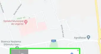
2Type a location into the search box. It’s at the top-left corner of the screen. You can type an address, intersection, business, landmark, or any other type of location into the box. A list of results will appear.Advertisement
-
3Click the location in the search results. This centers the map on the selected location.
-
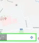
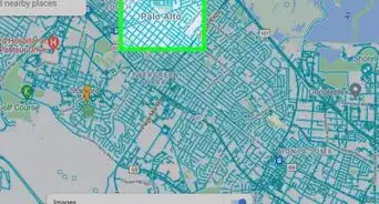
4Click +. It’s a button near the bottom-right corner of the screen. This zooms in. Keep clicking it until you’re zoomed in as far as you need.
- If you’re using a mouse with a scroll wheel, you can scroll it upward to zoom in.
- If your computer has a trackpad, you may be able to touch it with two fingers and then drag them upward to zoom.
-
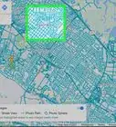
5Click - to zoom back out. It’s below the button you used to zoom in.
- If you have a mouse with a scroll wheel, scroll back down to zoom out.
- If you used two fingers on a touchpad, drag them downward to zoom out.
Advertisement


About This Article

Nicole Levine, MFA
Tech Specialist
This article was written by Nicole Levine, MFA. Nicole Levine is a Technology Writer and Editor for wikiHow. She has more than 20 years of experience creating technical documentation and leading support teams at major web hosting and software companies. Nicole also holds an MFA in Creative Writing from Portland State University and teaches composition, fiction-writing, and zine-making at various institutions. This article has been viewed 6,395 times.
How helpful is this?
Co-authors: 1
Updated: May 15, 2018
Views: 6,395
Categories: Google Maps
Article SummaryX
1. Go to Google Maps.
2. Search for a place.
3. Click the place.
4. Click + to zoom in.
5. Click - to zoom out.
Did this summary help you?
Advertisement